Welcome to the Headcount Analyst page for ELBERT 200
| Elbert County, Colorado | |
|---|---|
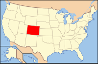
 Location in the U.S. state of Colorado |
|
 Colorado's location in the U.S. |
|
| Founded | February 2, 1874 |
| Named for | Samuel Hitt Elbert |
| Seat | Kiowa |
| Largest town | Elizabeth |
| Area | |
| • Total | 1,851 sq mi (4,794 km2) |
| • Land | 1,851 sq mi (4,794 km2) |
| • Water | 0.2 sq mi (1 km2), 0.01% |
| Population (est.) | |
| • (2015) | 24,735 |
| • Density | 12/sq mi (5/km²) |
| Congressional district | 4th |
| Time zone | Mountain: UTC-7/-6 |
| Website | www |
source: Wikipedia